 In recent decades, changes in climate have caused impacts on natural and human systems on all continents and across the oceans (IPCC, 2012). However, increases in climate variability have a greater effect on society than do changes in mean climate because it is more difficult to adapt to changes in extremes (Seneviratne et al., 2006). Europe was struck by record breaking extreme events, namely the mega-heat waves of 2003 in Europe (Trigo et al., 2005) and 2010 in Russia (Barriopedro et al., 2011; Bastos et al., 2014), and the large droughts in southern Europe in 2005 (Garcia-Herrera et al., 2007; Gouveia et al., 2009) and 2012 (Trigo et al., 2013). The last IPCC assessment on extreme events (IPCC, 2012) confirms that a changing climate can lead to changes in the frequency, intensity, spatial extent, duration, and timing of weather and climate extremes that combined with larger exposure can result in unprecedented risk to humans and ecosystems.
Several studies have also stressed the role played by recent climate change in the increase likelihood of occurrence of some of these extremes (Donat et al., 2013; Sillmann et al., 2013; Seneviratne et al., 2014; Ummenhofer and Meehl, 2017).
Conversely, compound climate extremes (concurrent occurrence of different extremes) have not been equally addressed, but are now receiving increasing attention because of their uneven impacts on humans and ecosystems (Lindner et al., 2010).
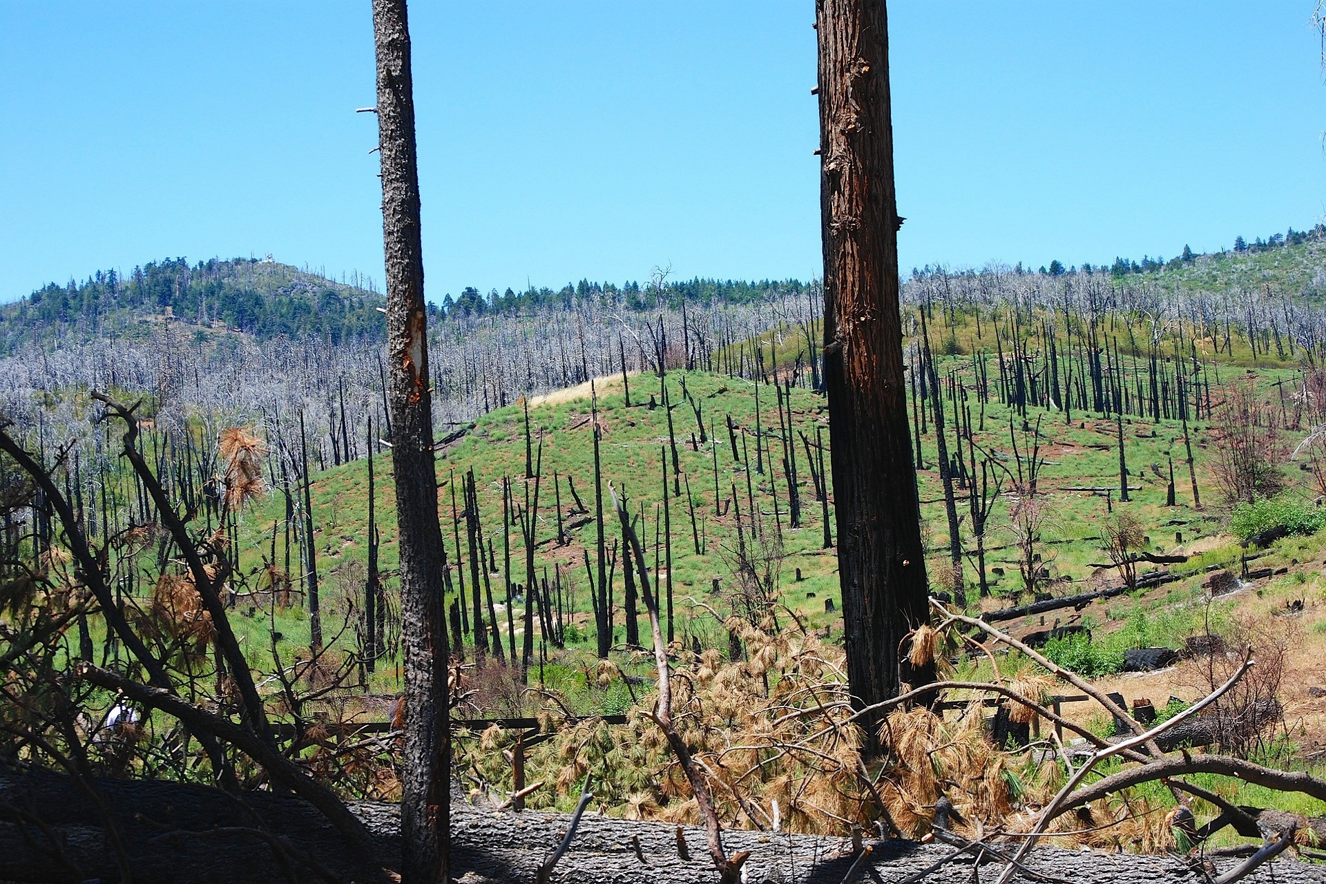
Risk assessments, however, generally focus on univariate statistics even when multiple stressors are considered. For example, concurrent extreme droughts and heat waves can substantially affect vegetation health, prompting tree mortality, and thereby facilitating insect outbreaks and fires (Mazdiyasni and AghaKouchak, 2015; Frank et al., 2015). Moreover, high temperatures may amplify drought effects by increasing water vapour pressure deficits and soil water stress (De Boeck et al., 2011). In a future climate, elevated CO2 may buffer effects of drought on vegetation productivity by increasing water use efficiency (Zhu et al., 2016). In addition, droughts and flash-droughts have the potential to trigger and intensify fires (Turco et al., 2017; Russo et al., 2017) and can cause severe economic damage (Mo and Lettenmaier, 2015), with no time for early-warnings in the case of flash-droughts (Mo and Lettenmaier, 2015). Thus, evidence on observed impacts as well as to climate change projected impacts on terrestrial ecosystems are mounting (Bastos et al., 2014; Gouveia et al., 2009; Lindner et al., 2010), suggesting significant vulnerability of both forest and agricultural ecosystems (Páscoa et al., 2017; Turco et al., 2017; Kurz-Besson et al., 2016; Gouveia et al., 2016).
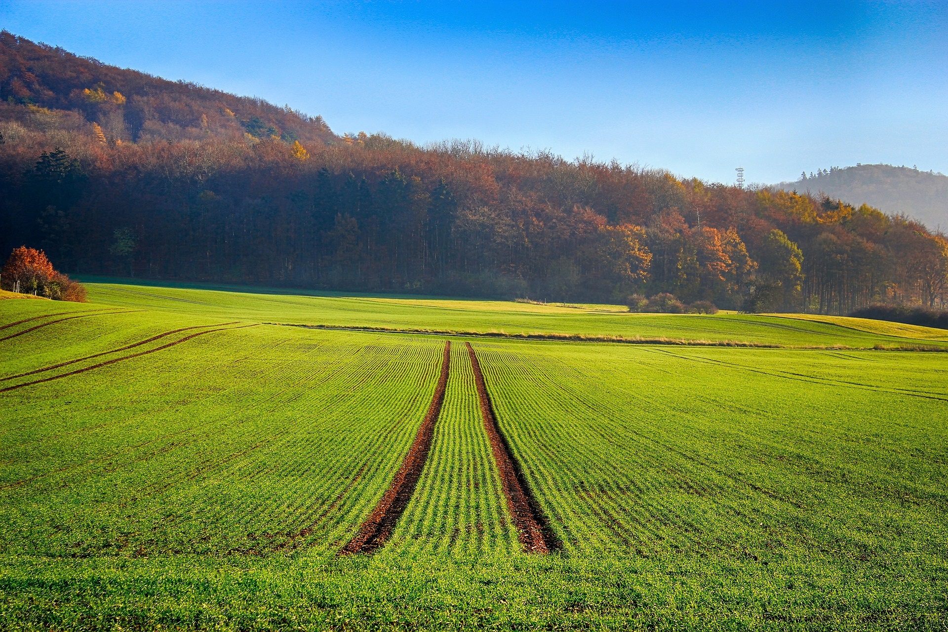
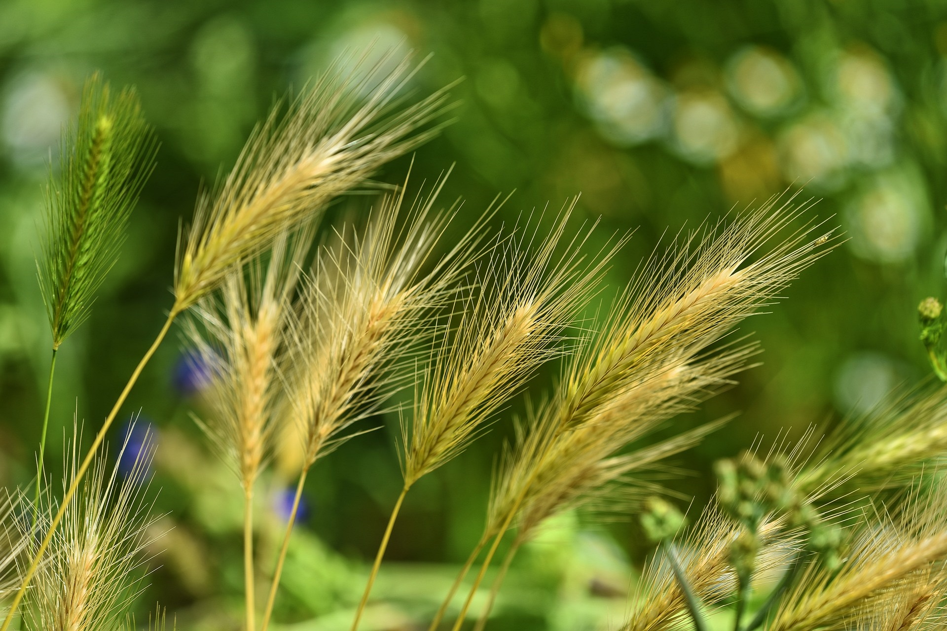
While changes in regional temperature and precipitation patterns may create better growing conditions for forest ecosystems in large areas (Lindner et al., 2010), the extinction of certain species from affected areas allows for large losses of sequestered carbon thus fueling CO2 emissions (Frank et al., 2015). In semiarid/arid biomes water scarcity strongly limits carbon sequestration, whereas the response in temperate biomes is more uncertain (Bloor et al., 2010). In fact, the intra-annual variability of precipitation may have a stronger effect on carbon balance than precipitation amount (Bastos et al., 2016) and the combined effect of former factors is crucial on dry biomes, as it determines critical soil moisture thresholds (Vargas et al., 2012). While climate extremes such as droughts, heat waves, or flash-droughts, hereafter HDE (Hot and Dry extremes), can cause substantial changes in terrestrial C fluxes, extreme changes in C fluxes are often, but not always, driven by extreme climate conditions (Frank et al., 2015; Zscheischler et al., 2014). Furthermore, HDE are key drivers for vegetation stress (Gouveia et al., 2009; Gouveia et al., 2012) and potentially responsible for crop yield and wood losses (Granier et al., 2007; Popova et al., 2014; Eilmann et al., 2011; Kurz-Besson et al., 2016). So, continuous monitoring of vegetation activity and a reliable estimation of HDE’ impacts is crucial to reduce potential risks.
Agricultural and forest risk management aim to mitigate crop and forest growth losses (Iglesias and Quiroga, 2007; Adams et al., 2009; Dalezios et al., 2014; Albert et al., 2015), highlighting the severe damages that can occur in the case of a concurrent effect of high temperature (Adams et al., 2009). The concept of risk is associated with the analytical components of risk analysis, i.e.: hazard, exposure and vulnerability (IPCC, 2012). Recently, Carrão et al. (2016) shown global maps of drought risk and found that drought hazard is generally high for the semiarid areas such as the Iberian Peninsula. Hence, HDE predictability and forecasting plays a major role in risk management to promote adaptation and mitigation measures that contribute to minimize the impacts resultant from these extreme events.
Several studies have focused on agricultural and forest risk assessment (Popova et al., 2014; Carrão et al., 2016; Petr et al., 2014), addressing the adverse effects of HDE in agriculture and forests worldwide, mostly using statistical approaches. Alternatively, Artificial Neural Networks (ANN) models are promising tools often regarded as a good compromise between simplicity and effectiveness (Morid et al., 2007; Jiang et al., 2004).
Due to the complexity of the non-linear character of the agricultural systems under drought conditions, ANN are good alternatives to classical statistical algorithms (Jiang et al., 2004). Usually, local risk management strategies focus only on short-term climatic events without considering long-term climate changes (IPCC, 2012), such as vegetation and soil moisture changes. According to the latest IPCC report (Trigo et al., 2013) the increased summer dryness in semi-arid regions (e.g. Mediterranean) reduces plant growth and survival rates leading to an evapotranspiration reduction and increased warming. The use of methodologies which account for different variables and time-scales (Carrão et al., 2016; Petr et al., 2014) and include compound events were used for applications involving future climate scenarios or for the development of predictive tools (Quesada et al., 2012). General Circulation Models (GCMs) provide a powerful tool to evaluate recent trends in a broader temporal context and to investigate the underlying mechanisms (Soares et al., 2012). Nevertheless, currently used GCMs have coarse horizontal resolutions being unable to represent many land-atmosphere interactions and systems that drive regional and local climate variability (Soares et al., 2012). Alternatively, the Regional Climate Models (RCMs), namely the Weather Research and Forecasting model (WRF, 2km to 9km resolutions), are physically consistent with regional and local circulations at finer horizontal and temporal scales (Soares et al., 2012; Cardoso et al., 2013).
Project Portfolio
IMPECAF aims to assess how extreme climate events like heatwaves, droughts and flash-droughts affect the Iberian Peninsula’s agriculture and forest systems. To accomplish this goal, risk analysis models will be developed including a panoply of climatic, hydrological and remote sensing data to generate new information relevant for risk management from a multidisciplinary perspective. Hence, different actions are planned to assess the risk of droughts, heatwaves and flash-droughts to yield and wood losses.
IMPECAF will obtain drought indices which are useful for drought monitoring and early warning and will integrate short and medium term meteorological predictions and numerical simulations for better predict extreme events.
IMPECAF will also assess the drought and heatwave impacts on vegetation communities and carbon uptake by ecosystems. These tasks will allow designing efficient risk models and produce information which will help in risk mitigation and insurance planning.
 IMPECAF aims to assess how extreme climate events like heatwaves, droughts and flash-droughts affect the Iberian Peninsula’s agriculture and forest systems. To accomplish this goal, risk analysis models will be developed including a panoply of climatic, hydrological and remote sensing data to generate new information relevant for risk management from a multidisciplinary perspective. Hence, different actions are planned to assess the risk of droughts, heatwaves and flash-droughts to yield and wood losses. IMPECAF will obtain drought indices which are useful for drought monitoring and early warning and will integrate short and medium term meteorological predictions and numerical simulations for better predict extreme events.
IMPECAF will also assess the drought and heatwave impacts on vegetation communities and carbon uptake by ecosystems. These tasks will allow designing efficient risk models and produce information which will help in risk mitigation and insurance planning.
TQ1: Is there a noticeable evolution of HDE in the Iberian Peninsula (IP) for the last 150 years?
TQ2: What is the expected level of significant changes in HDE occurrence under different future climate change scenarios?
TQ3: What are the main impacts of HDE in present and future state of yields and wood losses?
TQ4: What are the IP regions and crops that present higher vulnerability to HDE?
TQ5: Are crops and wood losses due to HDE measurable and therefore useful for insurance management?
TQ6: How much impact has the occurrence of drought, heat waves and wildfires on carbon sequestration over IP?
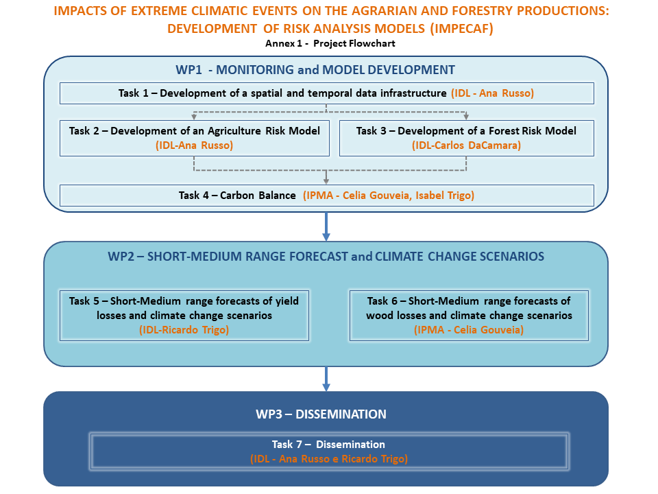
 The project consists of three work-packages (WP): 1) MONITORING and MODEL DEVELOPMENT, 2) SHORT-MEDIUM RANGE FORECAST and CLIMATE CHANGE SCENARIOS and 3) DISSEMINATION.
WP 1 includes Tasks 1, 2, 3, and 4, while WP2 embraces Tasks 5 and 6. Finally, WP3 encloses Task 7 which is solely devoted to dissemination.
Task 1 will be devoted to the development of a support infrastructure which will enclose all the data and be prepared to accommodate models' outputs and issue alerts. This Spatial Data Infrastructure (SDI) will be built to support collecting, storing, visualizing and disseminating the data needed for the other tasks. The information gathered in Task 1 will support all the remaining tasks. Within the framework of risk analysis, two risk models will be developed for yield and wood losses, corresponding to Tasks 2 and 3. Task 4 will make the bridge between the effects of climate extremes on the carbon cycle, synthesizing how different types of ecosystems are affected by HDE based on available well documented case studies. Task 4 will also provide an overview of likely responses of the terrestrial carbon cycle in relation to likely future HDE. Afterwards, Tasks 5 and 6 will be devoted to assess how forecasts and predictions will affect yield and wood losses in a short-medium range and in the 21st century. Finally, Task 7 will disseminate all the outcomes of the project through papers' publishing, meetings and workshops' organization.
Soon available
A) The drought and flash-drought indicators (Mo et al., 2015; Vicente-Serrano et al., 2010, 2014) will be obtained considering a multi-indicator approach to characterize droughts, using the highest resolution available datasets (Task 1) and the extreme heat indicators will be obtained based on the methodology in (Zhang et al.,2005). These indicators will use meteorological data sources (with the longest temporal span available), integrating new data from novel networks that include sensors recording relevant variables to quantify drought severity (e.g. solar radiation, heat fluxes), from new high spatial-resolution remote sensing images (e.g. MTG and Sentinel).
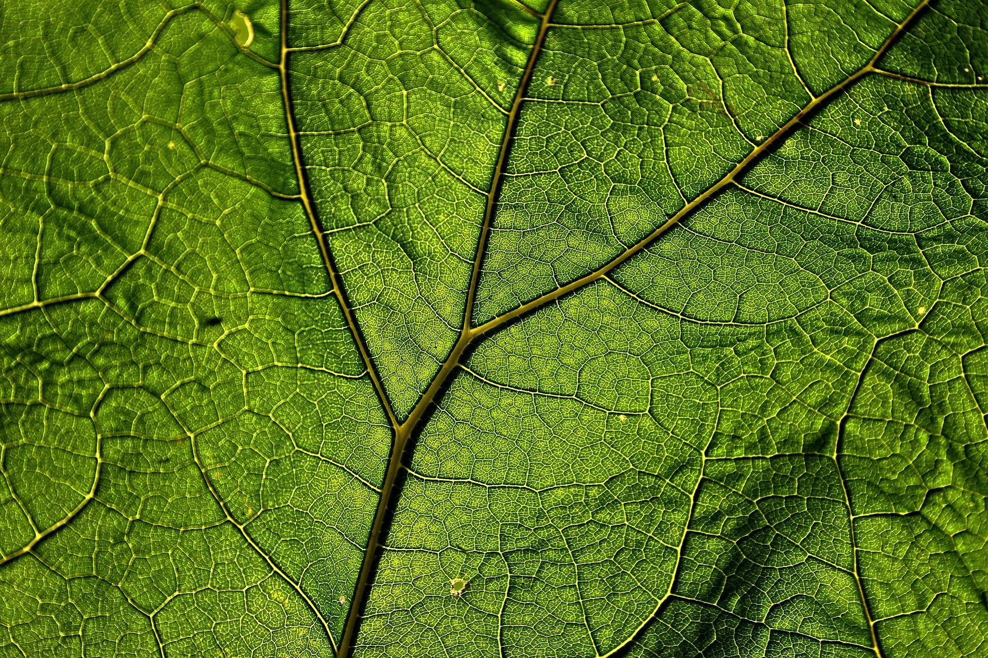
B) Information about vegetation will be obtained using Vegetation Indices acquired through remote sensing information (Nemani et al.,2003; Running et al., 2004), namely NOAA-AVHRR and MODIS, which have been widely used to analyze vegetation dynamic and climate impacts on vegetation (Gouveia et al., 2008, 2012; Trigo et al., 2010).
C) Statistical analysis will be used to develop drought impact curves for different vegetation types, crops and climate domains within the IP (Gouveia et al., 2009,2012; Granier et al., 2007);
D) The development of the Agriculture Risk Model (ARM) and Forest Risk Model (FRM) will encompass hazard, exposure and vulnerability analysis (Carrão et al., 2016). Hazard analysis aims to assess the duration, intensity and severity of the HDE which have major impacts on crop and wood losses Drought indicators, such as the Standardized Precipitation Index (SPI) and Standardized Precipitation and Evapotranspiration Index (SPEI), will be used to quantify the severity of the hazard. Exposure analysis will identify the more susceptible areas of the IP to HDE. Land cover change and vegetation response to HDE will be assessed by means of vegetation indices, such as the Normalized Difference Vegetation Index (NDVI) or the Enhanced Vegetation Index (EVI). Dryness trends and groundwater distribution will also be used to assess susceptibilities of the ecosystem to agricultural and forest losses. The areas corresponding to crops and forests in the IP are selected based on CORINE Land Cover (CLC) classification (Páscoa et al., 2017). The fraction of agricultural and agricultural irrigated land, population and soil characteristics will also be used to evaluate the vulnerability of crops and forests to HDE. ARM and FRM will be set up based on a comprehensive assessment of all significant statistical relationships observed between the HDE and the related agricultural and forestry losses (Páscoa et al.,2017; Russo et al.,2017; Gouveia et al.,2012). These links will be incorporated in both linear regression techniques and ANN methods applied for prediction of crop and biomass losses in the IP (Petr et al., 2014; Morid et al., 2007; Jiang et al., 2004). Moreover, return periods of the HDE and the associated social-economic losses of the agricultural and forestry elements will be estimated, to assist farmers and agro-forest insurance strategies. The ARM and FRM are computational tools that will allow issuing alerts and will function in operational mode at IPMA facilities.
E) High resolution simulations over the IP by the WRF model future and present climate simulations for the IP will be used to estimate climate change signal in the occurrence and intensity of the HDE and on the links between them and to crop and wood losses.
- Adams HD, Guardiola-Claramonte M, Barron-Gafford GA, Villegas JC, Breshears DD, Zhou CB, Troch PA, Huxman TE (2009) Temperature sensitivity of drought-induced tree mortality portends increased regional die-off under global-change-type drought. PNAS 106(17):7063–7066, doi:10.1073/pnas.0901438106
- Albert M, Hansen J, Nagel J, Schmidt M, Spellmann H (2015) Assessing risks and uncertainties in forest dynamics under different management scenarios and climate change. Forest Ecosyst 2(1):1–21. doi:10.1186/s40663-015-0036-5
- Barriopedro, D., Fisher, E., Luterbacher, J., Trigo, R.M., and García-Herrera, R. (2011) The hot summer of 2010: redrawing the temperature record map of Europe. Science, 322, 220. DOI: 10.1126/science.1201224.
- Bastos, A., Gouveia, C.M., Trigo, R.M, Running, S.W. (2014)Analysing the spatio-temporal impacts of the 2003 and 2010 extreme heatwaves on plant productivity in Europe. Biogeosciences, 11, 3421–3435. doi:10.5194/bg-11-3421-2014
- Bloor, J.M.G., Pichon., P., Falcimagne, R., Leadley, P., Soussana, J.-F. (2010)Effects of warming summer drought and CO2 enrichment on aboveground biomass production, flowering phenology, and community structure in an upland glassland ecosystem. Ecosystems, 13, 888-900. doi:10.1007/s10021-010-9363-0
- Cardoso, R.M., Soares, P.M.M., Miranda, P.M.A., Belo-Pereira, M. (2013)WRF high resolution simulation of Iberian mean and extreme precipitation climate. International Journal of Climatology. 33, 2591-2608. doi: 10.1002/joc.3616.
- Carrão H, Naumann G, Barbosa P (2016)Mapping global patterns of drought risk: An empirical framework based on sub-national estimates of hazard, exposure and vulnerability. Glob Environ Chang 39:108–124. doi: 10.1016/j.gloenvcha.2016.04.012.
- Dalezios NR, Blanta A, Spyropoulos N V, Tarquis a M (2014)Risk identification of agricultural drought for sustainable Agroecosystems. Nat hazards earth Syst Sci 14:2435–2448. doi: 10.5194/nhess-14-2435-2014
- De Boeck HJ, Dreesen FE, Janssens IA, Nijs I (2011) Whole-system responses of experimental plant communities to climate extremes imposed in different seasons. New Phytologist, 189, 806-817. doi:10.1111/j.1469-8137.2010.03515.x
- Eilmann, B., Zweifel, R., Buchmann, N., Pannatier, E.G., Rigling, A., (2011) 1. Drought alters timing, quantity, and quality of wood formation in Scots pine. J Exp Bot 2011; 62 (8): 2763-2771. doi: 10.1093/jxb/erq443.
- Frank, D., Reichstein, M., Bahn, M., Thonicke, K., Frank, D., Mahecha, M. D., Smith, P., van der Velde, M., Vicca, S., Babst, F., Beer, C., Buchmann, N., Canadell, J. G., Ciais, P., Cramer, W., Ibrom, A., Miglietta, F., Poulter, B., Rammig, A., Seneviratne, S. I., Walz, A., Wattenbach, M., Zavala, M. A., Zscheischler, J. (2015)Effects of climate extremes on the terrestrial carbon cycle: concepts, processes and potential future impacts. Global Change Biology, 21, 8, pp. 2861—2880. doi:10.1111/gcb.12916
- Garcia-Herrera R., Paredes D., Trigo R.M., Trigo I.F., Hernández H., Barriopedro D., Mendes M.T. (2007)The outstanding 2004-2005 drought in the Iberian Peninsula: associated atmospheric circulation. Journal of Hydrometeorology, 8, 483-498. doi:10.1175/JHM578.1
- Gouveia C., Trigo R.M., DaCamara C.C. (2009)Drought and vegetation stress monitoring in Portugal using satellite data. Natural Hazards and Earth System Sciences, 9, 1-11, doi:10.5194/nhess-9-185-2009
- Gouveia C., Trigo R.M., DaCamara C.C., Libonati R., Pereira J.M.C. (2008)The North Atlantic Oscillation and European vegetation dynamics. International Journal of Climatology, 28, 1835-1847, DOI: 10.1002/joc.1682
- Gouveia C.M., Bastos A., Trigo R.M., DaCamara C.C. (2012)Drought impacts on vegetation in the pre-and post-fire events over Iberian Peninsula. Nat Hazards Earth Syst Sci 12:3123–3137, DOI: 10.5194/nhess-12-3123-2012
- Gouveia C.M., Páscoa P., Russo A., Trigo, R.M. (2016)Land degradation assessment over Iberia during 1982-2012. Cuadernos de Investigacion Geografica, 42, 89-112. DOI: 10.18172/cig.2945
- Granier, A., Reichstein, M., Bréda, N. et al. (2007)Evidence for soil water control on carbon and water dynamics in European forests during the extremely dry year: 2003. Agricultural and Forest Meteorology, 143, 123–145. DOI: 10.1016/j.agrformet.2006.12.004
- Iglesias A, Quiroga S (2007)Measuring the risk of climate variability to cereal production at five sites in Spain.Clim Res 34:47–57. doi: 10.3354/cr034047
- C. B. Field, V. Barros, T. F. Stocker, D. Qin, D. J. Dokken, K. L. Ebi, et al.(2012)IPCC - Intergovernmental Panel on Climate Change. Managing the risks of extreme events and disasters to advance climate change adaptation, in A Special Report of Working Groups I and II of the Intergovernmental Panel on Climate ChangeCambridge, UK; New York, NY, USA: Cambridge University Press, 582.
- Jiang, D., Yang, X., Clinton, N., Wang, N. (2004)An artificial neural network model for estimating crop yields using remotely sensed information.Int J Remote Sens 25:1723–1732. doi: 10.1080/0143116031000150068
- Kurz-Besson C., Lousada J. L., Gaspar M. J., Correia I., Soares P. M. M., Cardoso R. M., Russo A., Varino F., Mériaux C., Trigo R.M. and Gouveia C. M. (2016)Effects of Recent Minimum Temperature and Water Deficit Increases on Pinus pinaster Radial Growth and Wood Density in Southern Portugal (special issue "Tree responses to extreme events").Front Plant Sci. 2016; 7: 1170. doi: 10.3389/fpls.2016.01170
- Lindner, M., Maroschek, M., Netherer, S., Kremer, A., Barbati, A., Garcia-Gonzalo, J. et al. (2010)Climate change impacts, adative capacity, and vulnerability of European forest ecosystems.Forest Ecology and Management, 259, 698–709, doi: 10.1016/j.foreco.2009.09.023
- Mazdiyasni, O., AghaKouchak, A. (2015)Substantial increase in concurrent droughts and heatwaves in the United States. Proceedings of the National Academy of Sciences of the United States of America, 112(37), 11484–11489, doi:10.1073/pnas.1422945112
- Mo, K. C., and D. P. Lettenmaier (2015)Heat wave flash droughts in decline. Geophys. Res. Lett., 42, 2823–2829, doi:10.1002/2015GL064018
- Morid, S., Smakhtin, V. and Bagherzadeh, K. (2007)Drought forecasting using artificial neural networks and time series of drought indices. Int. J. Climatol., 27: 2103–2111. doi:10.1002/joc.1498
- Nemani R.R., Keeling C.D., Hashimoto H., Jolly W.M., Piper S.C., Tucker C.J., Myneni R.B., Running S.W. (2003)Climate-driven increases in Global Terrestrial Net Primary Production from 1992 to 1999. Science, 300, 1560-1563. doi:10.1126/science.1082750
- Páscoa P., C. M. Gouveia, A. Russo, R. M. Trigo (2017) The role of drought on wheat yield interannual variability in the Iberian Peninsula from 1929 to 2012. Int J Biometeorol, DOI: 10.1007/s00484-016-1224-x
- Petr, M., Boerboom, L., van der Veen, A., Ray, D. (2014) A spatial and temporal drought risk assessment of three major tree species in Britain using probabilistic climate change projections. Climatic Change (2014) 124:791-803, DOI 10.1007/s10584-014-1122-3
- Popova, Z., Ivanova, M., Martins, D., et al. (2014) Vulnerability of Bulgarian agriculture to drought and climate variability with focus on rainfed maize systems. Nat Hazards 74:865–886. doi: 10.1007/s11069-014-1215-3
- Quesada, B., Vautard, R., Yiou, P., Hirschi, M., Seneviratne, S.I. (2012) Asymmetric European summer heat predictability from wet and dry southern winters and springs. Nature Climate Change, 2, 736-741, doi:10.1038/nclimate1536
- Running S.W., Nemani R.R., Heinsch F.A., Zhao M., Reeves M., Hashimoto H. (2004) A continuous satellite-derived measure of global terrestrial primary production. BioScience, 56(6), 547-560, doi:10.1641/0006-3568(2004)054[0547:ACSMOG]2.0.CO;2
- Russo, A., Gouveia, C.M., Páscoa, P., DaCamara, C.C., Sousa, P.M., Trigo R.M. (2017) Assessing the role of drought events on wildfires in the Iberian Peninsula. Agricultural and Forest Meteorology, doi:10.1016/j.agrformet.2017.01.021
- Seneviratne S., Lüthi D., Litschi M., Schär C. (2006) Land–atmosphere coupling and climate change in Europe. Nature Letters, 443, doi:10.1038/nature05095
- Soares, P.M.M., Cardoso, R.M., Medeiros, J., Miranda, P.M.A., Belo-Pereira, M., Espirito-Santo, F. (2012) WRF High Resolution Dynamical Downscaling of ERA-Interim for Portugal. Climate Dynamics. 39, 2497-2522. doi: 10.1007/s00382-012-1315-2
- Trigo R.M., Añel J., Barriopedro D., García-Herrera R., Gimeno L., Nieto R., Castillo R., Allen M.R., Massey N. (2013) The record Winter drought of 2011-12 in the Iberian Peninsula, in Explaining Extreme Events of 2012 from a Climate Perspective. Bulletin of the American Meteorological Society, 94 (9), S41-S45
- Trigo R.M., Gouveia C., Barriopedro D. (2010) The intense 2007-2009 drought in the Fertile Crescent: Impacts and associated atmospheric circulation. Agr. Forest Meteorol, 150, 1245-1257, doi:10.1016/j.agrformet.2010.05.006
- Trigo, R.M., García-Herrera, R., Díaz, J., Trigo, I.F., Valente, M.A. (2005) How exceptional was the early August 2003 heatwave in France? Geophysical Research Letters, 32, L10701, doi:10.1029/2005GL02241
- Turco M., von Hardenberg J., AghaKouchak A., Llasat M.C., Provenzale A., Trigo R.M. (2017) On the key role of droughts in the dynamics of summer fires in Mediterranean Europe. Scientific Reports, 7:81, doi:10.1038/s41598-017-00116-9
- Vargas, R., Collins, S.L., Thomey, M.L., Johnson, J.E., Brown, R.F., Natvig, D.O., Friggens, M.T. (2012) Precipitation variability and fire influence the temporal dynamics of soil CO2 efflux in an arid grassland Global Change Biology, 18, 1401-1411, doi:10.1111/j.1365-2486.2011.02628.x
- Vicente-Serrano, S.M., Beguería, S., López-Moreno, J.I. (2010) A Multi-scalar drought index sensitive to global warming: The Standardized Precipitation Evapotranspiration Index – SPEI Journal of Climate, 23, 1696-1718, doi:10.1175/2009JCLI2909.1
- Vicente-Serrano, S.M., Lopez-Moreno, J.-I., Beguería, S., et al (2014) Evidence of increasing drought severity caused by temperature rise in southern Europe. Environ Res Lett 9:4400, doi: 10.1088/1748-9326/9/4/044001.
- Zhang, X., et al. (2005) Trends in Middle East climate extreme indices from 1950 to 2003. Res., 110, D22104, doi:10.1029/2005JD006181.
- Zhu Z, Piao S, Myneni RB, et al Greening of the Earth and its drivers. Nat Clim Chang.Advance online publication.2016;6(8):791–795. 10.1038/nclimate3004.
- 1. Zscheischler, J., Michalak, A.M., Schwalm, C., Mahecha, M.D.,Huntzinger, D.N., Reichstein, M. Berthier, G., Ciais, P., Cook, R.B., El-Masri, B., Huang, M., Ito, A., Jain, A., King, A., Lei, H., Lu, C., Mao, J., Peng, S., Poulter, B., Ricciuto, D., Shi, X., Tao, B., Tian, H., Viovy, N., Wang, W., Wei, Y., Yang, J., Zeng, N. (2014) Impact of large-scale climate extremes on biospheric carbon fluxes: An intercomparison based on MsTMIP data. Global Biogeochem. Cycles, 28, 585–600, doi:10.1002/2014GB004826.